“Having obtained indisputable data on Herodotus’s sea voyage around the Crimean Peninsula, confirming the high accuracy of his measurements, we must return to those definitions of the Black Sea’s size that so discredited Herodotus in the eyes of scholars.
Describing Pontus, Herodotus says:
“Of all the seas, this is the most remarkable. It is 11,100 stadia long, and 3,300 at its widest point…” (§ 85).
“I made these measurements as follows: a ship usually travels almost 70,000 orgies during a fairly long day, and 60,000 during a night. Meanwhile, from the mouth of the Pontus to Phasis (which constitutes the longest part of the Pontus), the voyage lasts 9 days and eight nights, and this gives 1,110,000 orgies, or 11,100 stadia.
To Themiscyra, which is on the river Thermodon, from Sindica (at this place Pontus is at its widest) is a three-day and two-night voyage, which is 33,000 orgia, or 3,300 stadia. In this way I measured Pontus…” (§ 86).
Translated into the metric system, this gives us (taking the Athenian stadium as 177.6 m) 1,953.6 km for the longitudinal measurement of the Black Sea and 585 km for its meridional diameter.
The actual dimensions do differ greatly from Herodotus’ calculations: the longitudinal extent of the sea from the Bosphorus to the mouth of the Rion on the Caucasian coast (“from the mouth of Pontus to Phasis”) is about 1080 km and from Anapa almost to the mouth of the Yesil-Irmak River on the southern coast (“from Sindica to Thermodon”) is about 400 km. Herodotus’ measurements turn out to be clearly exaggerated compared to our measurements in a straight line.
In ancient geography, there was no single, established viewpoint on the parameters of Pontus. This is evidenced by the summary compiled by Pliny the Elder, who used data from Artemidorus, Agrippa, Mucianus, Cornelius Nepos, and Marcus Varro.
The discrepancies between the authors reach 700 km. It is crucial to note that all of the authors listed above did not provide linear measurements of the length and width of the Black Sea, but rather the sea’s circumference or measurements of the European coastline alone, from the Thracian Bosporus to the Cimmerian Bosporus.
And these measurements were taken as the ship entered various harbors. The total length of the European coastline was determined (as is evident from Marcus Varro’s data, cited by Pliny) by the sum of the individual distances between harbors:
“From the entrance to Pontus to Apollonia—187,500 ‘steps’
from here to Callatia—the same (187,500)
from here to the mouth of the Ister—125,000
from the Ister to the Borysthenes—250,000
to the Heraclean city of [Tauric] Chersonesos—375,000
to Panticapaeum [Kerch], called by some the Bosporus, the extreme
point on the European side—212,500 steps
This makes a total of 1,337,500 steps.”
Marcus Varro measured the very route that interests us in relation to Herodotus’s proposed route. It should be noted that the distance is very imprecise: the coastline from the Bosphorus to the Kerch Strait (excluding minor bends) is approximately 1,400 km, while Varro estimated 1,900. It is possible that such an excess occurred due to entering small intermediate piers, when the ship’s movement resembled a garland bordering the shore.
If we approach Herodotus’ calculations from the point of view of coastal, cabotage navigation, we will see that they correspond quite accurately to the actual measurements of the coastal line along the Black Sea coast from the Bosphorus to Olbia and further past Crimea and the Kerch Strait to the very mouth of the Rion, to Phasis, “where the ships turn their course.”
Herodotus’s reputation has been restored: he measured not the geometric diameter of the Black Sea, as scholars believed, but the actual distance a ship would have to sail to reach the opposite point in Colchis at the mouth of the Phasis. And he measured it, it must be said, much more accurately than Roman geographers did several centuries later. Such precise measurement of the Black Sea coastal route once again confirms the above-mentioned assumption about Herodotus’s sea voyage from Olbia eastward around Taurica and to the Kerch Strait.” (Academician B. Rybakov, Scythia of Herodotus)
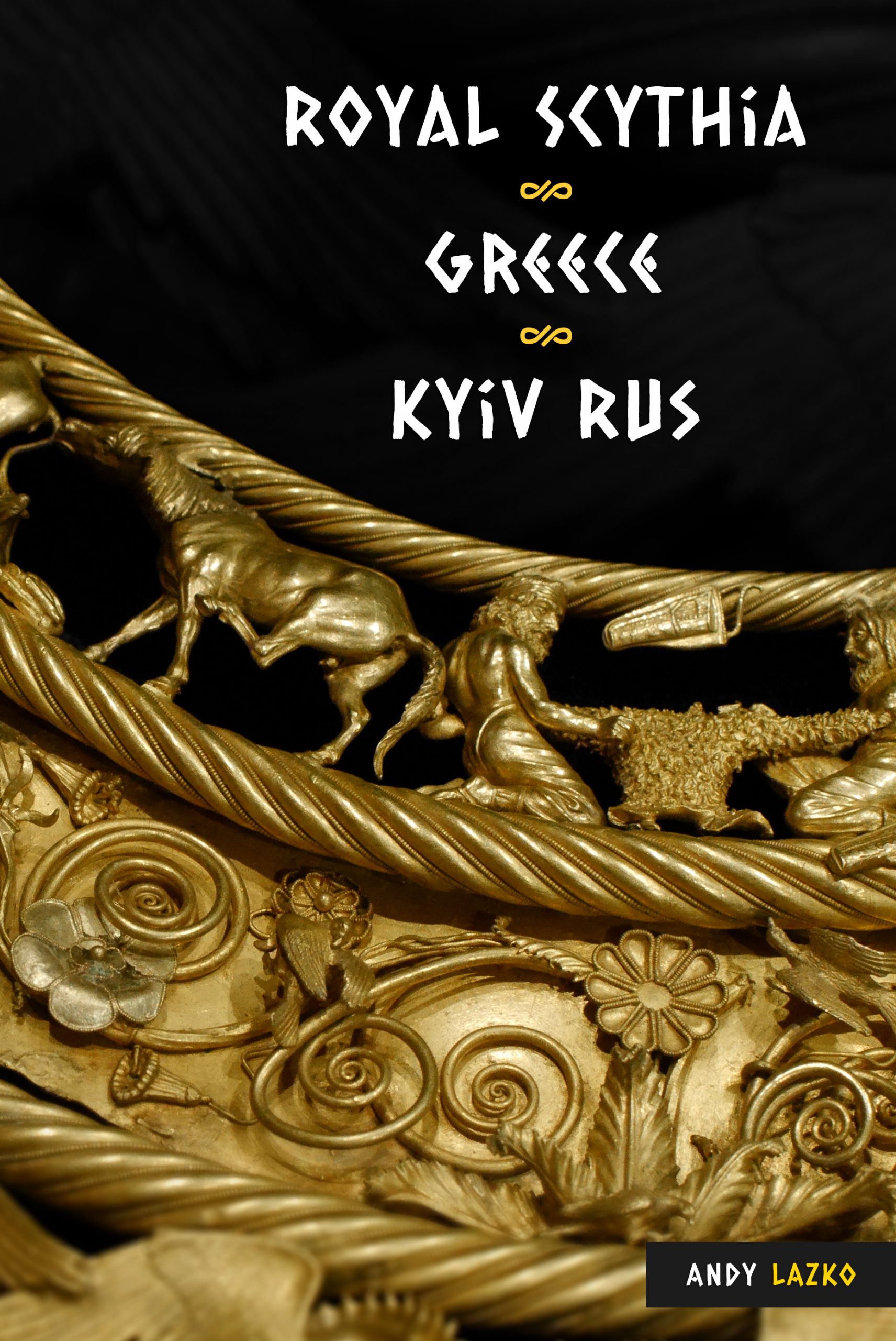
The book “Royal Scythia, Greece, Kyiv Rus” has a little-known story of a Scythian king saving Athens from famine by sending ships with grain.